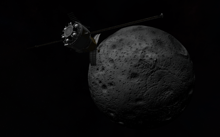
Originally purposed to be a mapping satellite for Kerbin, the previous launches have proven quite adequate at that task! So instead the craft that was planned for the Surveyor 3 launch will be re-purposed for surveying the surface of Mun! 
Surveyor launches using an automated system called Ascent Guidance – no satellite has been launched before using this system, so engineers are eager to see how well it performs the orbital burn! 
Amazingly, it seems to go very well!
It’ll be nice to have the computer be able to launch these more routine missions!
-Val
Mun Surveyor reaches… Mun! A polar orbit is set for the scan, at an altitude of roughly 300k – an altitude ideal for multi-spectral biome scanning!-